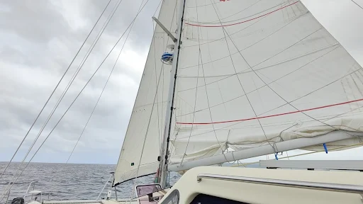
The wind has been unpredictable, ranging from 2 to 32 knots and shifting around during the day and it's been sitting at 30 most of the night. The weather has been a mix of sunshine and rain, making for an interesting 24hrs.
Despite being only 16 degrees south of the equator, it's still not as warm as I expected.
At one point, a ship came within half a mile of us. Before AIS, a ship heading towards us would have meant a lot of drama. We would have to estimate its course with binoculars, and to constantly check the bearings and decide if we should change course to avoid a collision. Now, we have all that information displayed on the chart plotter from 20 nautical miles away. Half a mile might not seem like much, but at sea it's considered a very close encounter.
Before we had chart plotters "back in the day" we occasionally had to navigate with charts which were photocopies of photocopies and were so degraded that they had holes in them. We had no idea what was under those holes, so we had to sail around them to avoid any surprises. Once, when we were having an unplanned arrival at Rarotonga, the chart was so poor that we couldn't see the island marked on it. Only the name was clear, so we had to sail around the name, looking for the island. But now, thanks to advances in technology, we have chart plotters that can overlay radar, AIS, and even Google Earth images. This makes navigation much easier though I'm not sure if it's safer as there is a risk of becoming too reliant on it. It's easy to put yourself in a position that would have been unthinkable 20 years ago, and a sudden system failure can be disastrous. For example I wouldn't have considered entering Port Vila at nighttime and we would have slowed down to time our arrival in day light.
